Hurricanes form when a suitable cluster of tropical thunderstorms develops an organized, rotating circulation over warm ocean water. Evaporation supplies moisture, condensation releases energy in rising air, and the surrounding atmosphere must allow that convection to remain organized. Warm water is essential to many developing storms, but it is not sufficient by itself.
A hurricane is a kind of tropical cyclone. The same broad class of storm is called a typhoon in parts of the western North Pacific and a cyclone in several other ocean regions. The regional names do not describe different basic laws of physics.
Begin with a disturbance, not an empty patch of sea
Many tropical cyclones develop from an existing weather disturbance, such as a tropical wave or an organized group of thunderstorms. The disturbance provides a starting pattern of rising air and circulation. Most disturbances never become hurricanes because one or more favorable conditions fail to persist.
Near the surface, air flows toward a developing low-pressure region. Over sufficiently warm water, evaporation adds water vapor and transfers energy into that air. Rising moist air can then form clouds and release latent heat when vapor condenses.
That heating helps maintain a warm atmospheric column and can support further pressure falls and stronger low-level inflow. The developing system is a feedback process involving ocean heat, moisture, convection, and circulation. It is not simply a cloud expanding until it becomes large enough to receive a new name.
Warm ocean water is an energy reservoir
Introductory descriptions often use sea-surface temperatures near 26.5°C to 27°C, roughly 80°F, as a favorable benchmark. The NOAA hurricane resource uses this broad threshold while listing other necessary conditions. It is a guideline, not an on-off switch or a guarantee of formation.
The depth of the warm layer matters too. Strong winds can mix cooler water from below into the surface layer. If warm water is only a thin skin, that mixing may reduce the energy available to the storm more quickly than it would over a deep warm layer.
The ocean supplies both thermal energy and moisture. A warm atmosphere over land does not automatically provide an equivalent replacement once the circulation loses contact with the ocean. Water's heat capacity and phase changes are central to the storm's energy budget.
This is different from the reason seawater is salty. Salinity influences ocean density and mixing, but salt itself is not hurricane fuel. The energy source is primarily the heat exchanged between the warm ocean, moist air, and colder upper environment.
Condensation redistributes energy
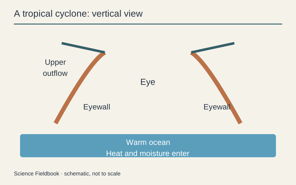
Evaporating liquid water requires energy, which becomes associated with water vapor. When that vapor condenses higher in the storm, latent heat is released to the surrounding air. This energy transfer helps explain how the warm ocean can support vigorous clouds far above the surface.
Condensation does not create energy from nothing, and individual raindrops are not tiny engines driving the wind directly. The organized circulation arises from pressure gradients, buoyancy, Earth's rotation, and the storm's evolving structure.
An introductory diagram can show rising moist air and upper-level outflow, but it compresses a three-dimensional, turbulent flow into a few arrows. Real storms contain many convective towers and changing pathways rather than one perfectly smooth loop.
Why rotation matters
Air moving over a rotating Earth is deflected relative to the surface. This Coriolis effect helps organize the broad circulation around a tropical low. It is weak close to the equator, which is one reason tropical cyclones rarely form directly on the equator.
In the Northern Hemisphere, the low-level winds around a typical tropical cyclone rotate counterclockwise. In the Southern Hemisphere they rotate clockwise. Those directions describe the broad circulation, not every turbulent motion within a storm.
The effect does not mean Earth's rotation suddenly spins a previously motionless cloud like a toy top. Existing vorticity, converging flow, and the storm's size all matter. As air moves inward, the circulation can become more concentrated under suitable conditions.
Moisture and instability help sustain the thunderstorms
A developing cyclone needs an atmosphere favorable for moist convection. If rising air remains warmer and less dense than its environment after condensation begins, it can continue rising. The temperature structure aloft therefore matters alongside the ocean surface.
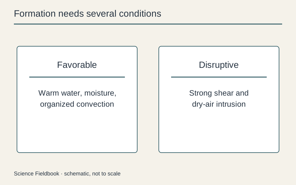
Moist air in the middle atmosphere also helps. Dry air mixed into cloud systems can increase evaporation of droplets and cool the air, weakening or disrupting the organized convection. A warm ocean under a hostile upper atmosphere may fail to produce a tropical cyclone.
These ingredients overlap with the ingredients of thunderstorms and lightning. However, a tropical cyclone's large-scale organization and ocean coupling introduce additional requirements. Individual thunderstorms can form and decay within a broader rotating system.
Why low wind shear is usually favorable
Vertical wind shear means that wind speed or direction changes with height. Strong shear can tilt the developing circulation and displace thunderstorms away from the low-level center. That makes it harder for the system's heating and circulation to reinforce one another.
Low shear helps the system remain vertically organized. It does not mean that winds within the hurricane are weak. A powerful cyclone can have extremely strong circulating winds while the difference in the surrounding environmental wind between lower and upper levels remains comparatively modest.
This distinction prevents a common misunderstanding: “high wind” and “high wind shear” are not interchangeable phrases. One describes speed; the other describes variation with height or position. The pattern matters as much as the largest number.
The eye, eyewall, and rainbands
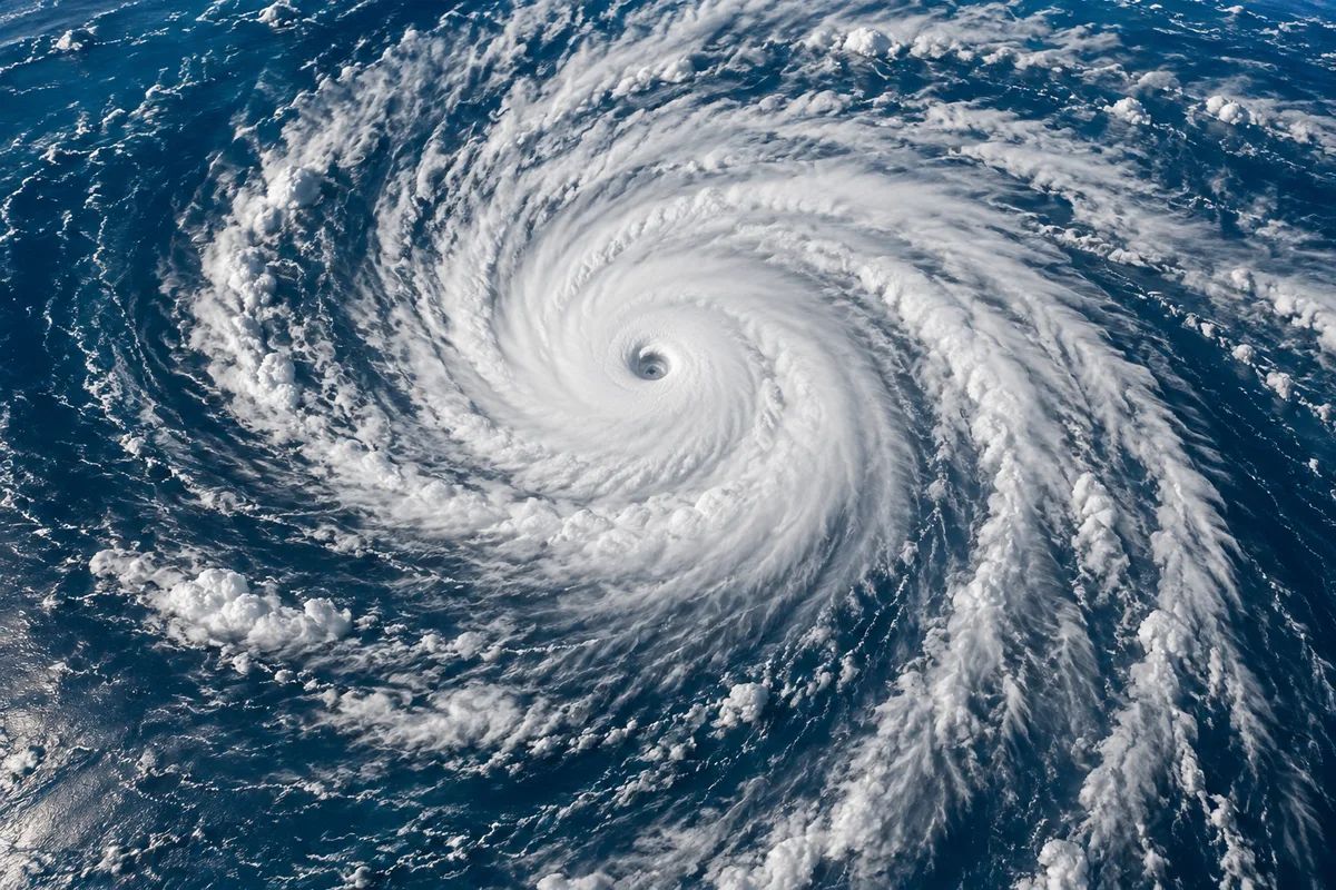
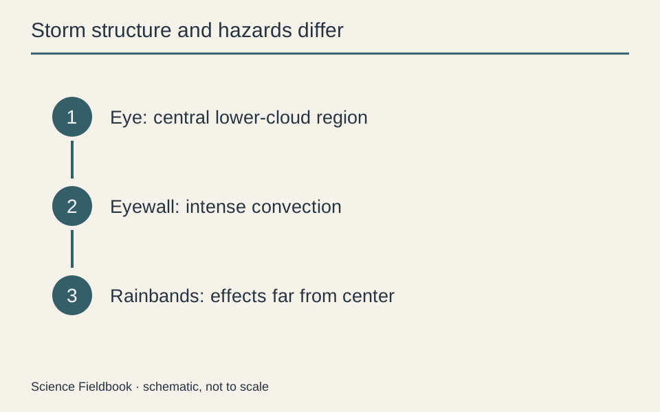
A sufficiently organized intense cyclone may develop an eye, a central region with relatively light winds and descending air. The eye is surrounded by an eyewall containing vigorous thunderstorms and some of the strongest winds. The transition from eye to eyewall can be abrupt.
Spiral rainbands extend outward and can bring heavy rain, gusty winds, and other hazards far from the center. Storm size and peak wind speed are different properties. A larger cyclone can affect a wider area even when its highest sustained wind is lower than that of a more compact storm.
The eye is not a hole extending down through a rigid spinning wall of cloud. Its appearance reflects air motion and cloud distribution in a changing atmospheric system. Some developing or weaker tropical cyclones do not have a sharply defined eye at all.
Classification does not summarize every hazard
In the Atlantic and eastern North Pacific, a tropical cyclone reaches hurricane intensity when its maximum sustained winds reach 74 miles per hour under the relevant observing convention. Other regional agencies use different naming and measurement practices, so international comparisons require care.
Wind-based categories do not measure storm surge, total rainfall, inland flooding, or the size of the affected region. A storm that weakens before landfall can still be dangerous because water hazards and large waves do not vanish when a wind number changes.
For personal decisions, follow the current forecasts, warnings, and evacuation instructions issued by responsible local authorities. This article explains formation and structure, not the conditions at any particular coastline or an individual property's risk.
Why hurricanes weaken over land or cooler water
Crossing land usually reduces the supply of warm-ocean moisture and energy while increasing friction and disrupting the low-level circulation. Mountains and other terrain can further interfere with the storm. Cooler water or strong environmental shear can also undermine the energy supply and organization.
Weakening does not mean the remaining moisture disappears. A decaying system can continue delivering heavy rainfall over land, especially if its movement is slow. Remnants may also interact with other weather systems and undergo further changes.
Some cyclones transition into storms with a different structure and energy source outside the tropics. In that case, describing them only as hurricanes that “ran out of fuel” misses the interaction with broader temperature contrasts and atmospheric flow.
Formation, intensification, and movement are separate questions
Formation concerns the development of a closed, organized tropical circulation. Intensification concerns a change in its strength. Movement concerns where the system travels under the surrounding steering flow and its interactions with the environment. One favorable condition does not answer all three questions.
A warm ocean may support strengthening, yet the track still depends on larger atmospheric patterns. A storm can move into unfavorable shear and weaken, or cross a patch of high ocean heat content and strengthen more quickly. Its path and intensity forecasts therefore require different information, even though they interact.
Rapid intensification is especially challenging because small changes in the storm's inner organization can matter alongside the broad environmental conditions. Knowing that warm water and low shear are favorable does not provide an exact timetable for the next intensity change.
Why rain can remain a major inland hazard
A tropical cyclone contains a large moisture supply and organized regions of rising air. After landfall, its maximum winds may decrease while rain continues, sometimes enhanced by terrain or interaction with other weather systems. Slow forward motion can keep heavy rain over the same region for longer.
The wind category at the coast therefore cannot summarize the later flood risk inland. A community far from the eye can experience serious rainfall impacts without experiencing the highest hurricane winds. Storm surge is another separate process, involving wind and pressure effects on coastal water levels and local shoreline geometry.
The practical lesson is to follow the warnings for each hazard, rather than treating one declining wind number as a general all-clear. Formation science helps explain the storm's energy source, while current official forecasts supply the information needed for an actual event.
The takeaway
A hurricane requires more than hot weather. An initial disturbance, a sufficiently warm ocean, moisture, favorable atmospheric structure, enough rotational influence, and limited disruptive wind shear must combine. The resulting storm is a coupled ocean–atmosphere system whose water hazards can extend far beyond its strongest winds.
For another route through water and energy, explore how a heat pump transfers heat. The technologies and storms are very different, but both become easier to understand when energy sources, transfers, and losses are traced explicitly.